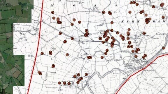
This event is being run on behalf of the Don Catchment Rivers Trust in support of the All Hands on the Don project. It is an introduction to digital mapping linked to the creation of a visualisation of the River Don and how it has changed over the last 400yrs or so. We will show participants how maps can be used to reveal the changes in landscapes over time. The workshop will use commonly available open-source mapping information to peel back the layers from the modern to the ancient landscape. This will include examples from LiDAR, the historical series of O/S maps, modern maps and aerial imagery. We will use some case-study examples to illustrate these. It will also look at using existing and historical features as reference points to help people understand the changing landscape.
There will be opportunities for discussion about the creation of the visualisation as well as the more formal presentations on using digital mapping.
The event is being held indoors in the centre of Doncaster at the Danum Gallery. Please bring a pencil and notebook with you.
Frais de réservation : 3,4% + £0.20 par réservation
VisDM25121 disponibles jusqu'au ven 5 déc. '25 10:15
|
Danum Gallery, Library and Museum
Waterdale
Doncaster
DN1 3BZ
bus stops nearby and it is a short walk from the train station
Commodités
